
by Emily Adams | Apr 29, 2014 | Free Resources, Our Blog
National Geographic has a depth of cartographic resources online! We\’ve been browsing their selection of educational content and found several free resources we thought you would enjoy sharing with your students. Location and Place in Your Classroom...

by Barbaree | Apr 22, 2014 | GIS Happenings, Our Blog
GISetc is wishing all a Happy Earth Day! Today we will post several pics on this blog and our social network channels to NASA to \”create an image of Earth from the ground up.\” Get outside today and take your#GlobalSelfie, help NASA and put yourself on...

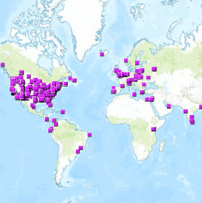
by Emily Adams | Apr 18, 2014 | Apps We Love, Free Resources, Our Blog
Tomorrow National Parks week opens! To kick off the celebration, enjoy FREE access to any national park this weekend. Find a National Park near you and explore all the maps the National Park Service has to offer. Follow this link to view the NPS\’ geospatial map...

by Emily Adams | Apr 15, 2014 | Free Resources, Our Blog
Happy tax day! (Is that an oxymoron?) We hope your taxes are filed & you\’re reading our blog, leisurely, with your feet up, eating bonbons. OR maybe you logged on for a break from sorting receipts and searching for an extension form… Either way...
by Emily Adams | Apr 10, 2014 | Free Resources, Our Blog
Interactive maps are wonderful tools to explore data. Ever use them to find others like you in your field? Today we\’re sharing a list of links to interactive maps, full of people like YOU. Whether you\’re a geospatial professional, teacher or student...
